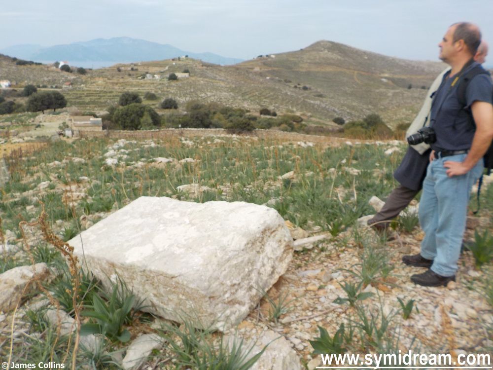
Coming down the hillside, to where we will join that riverbed, we came across a strange stone. One huge slab of white rock that has been dressed, you can see chisel marks in it, very worn so probably very old. Thing is, this rock must weigh a couple of tonnes and it is not the same rock as thereabouts; it had been brought here at some point, and for some reason. There is evidence around that the area may have been occupied; some straight edges to some of the ground rocks (or could that be coincidence?) and certainly some large ruined buildings including another windmill – lower down the ridge fromt the Roukouniotis windmill. So, the question is, what was this stone used for?
![Coming down the hillside, to where we will join that riverbed, we came across a strange stone. One huge slab of white rock that has been dressed, you can see chisel marks in it, very worn so probably very old. Thing is, this rock must weigh a couple of tonnes and it is not the same rock as thereabouts; it had been brought here at some point, and for some reason. There is evidence around that the area may have been occupied; some straight edges to some of the ground rocks (or could that be coincidence?) and certainly some large ruined buildings including another windmill – lower down the ridge fromt the Roukouniotis windmill. So, the question is, what was this stone used for? Our guesses ranged from a sacrificial altar, through a grave marker, to a chart table, which is what we used it as we laid out the map to see if it was marked as an historic monument. It wasn't. [Later that evening, I asked Sotiris at the supermarket if he had any ideas, as I know he has land and farms out that way. He told me it was a sacrificial altar, and laughed. He had no idea either. So, if you know, please put answers on a postcard and email them to me. Ta.] Back to the walk. From Aslan’s Table (my name for it) we headed across the hillside and over a wall, getting in a nice but mild bit of rock climbing, and then skirted along the edge of the riverbed, high up, traversing a dodgy part at one point with only a flimsy metal fence to cling to if we should slip – more rock climbing, brought back fond memories of my days in harness and ropes (but that’s another story) and almost gave me the bug back, and the vertigo was not an issue. And onwards… Now, if you are following this on a map, we are opposite the ancient landmark of 12 ΣΠΗΛΙΑ, or 12 Caves, of which there was not sight or sound. But talking of sound, here’s a little video where you can hear what the walk was like after we’d met the ponies and just after Aslan’s Table. They are goat bells you hear; a whole herd was coming down that hillside you can see in the middle distance. I’d provide you with the smell of wild oregano and sage (took some home) if I could, but that's not yet possible on a WordPress blog. So, onwards past the invisible Spilia, and now we round a corner where we can see the sea and Nimborio. And that’s for tomorrow when we find catacombs, mosaics and a glass of wine.](http://www.symidream.com/wp-content/uploads/2014/12/Walking-through-the-Kato-Meria-are-of-Symi-22.jpg)
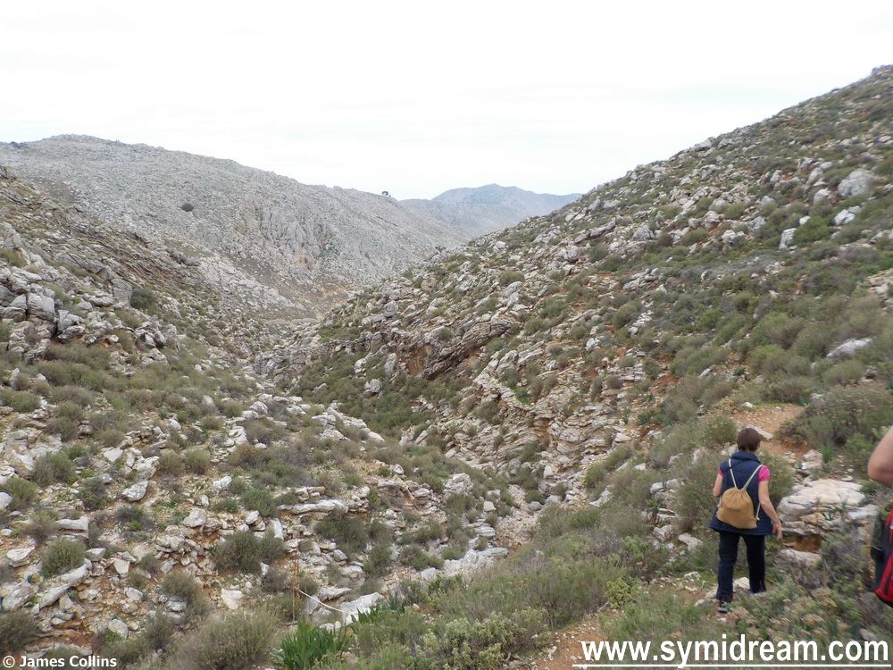
Back to the walk. From Aslan’s Table (my name for it) we headed across the hillside and over a wall, getting in a nice but mild bit of rock climbing, and then skirted along the edge of the riverbed, high up, traversing a dodgy part at one point with only a flimsy metal fence to cling to if we should slip – more rock climbing, brought back fond memories of my days in harness and ropes (but that’s another story) and almost gave me the bug back, and the vertigo was not an issue. And onwards…
Now, if you are following this on a map, we are opposite the ancient landmark of 12 ΣΠΗΛΙΑ, or 12 Caves, of which there was not sight or sound. But talking of sound, here’s a little video where you can hear what the walk was like after we’d met the ponies and just after Aslan’s Table.
They are goat bells you hear; a whole herd was coming down that hillside you can see in the middle distance. I’d provide you with the smell of wild oregano and sage (took some home) if I could, but that’s not yet possible on a WordPress blog. So, onwards past the invisible Spilia, and now we round a corner where we can see the sea and Nimborio.
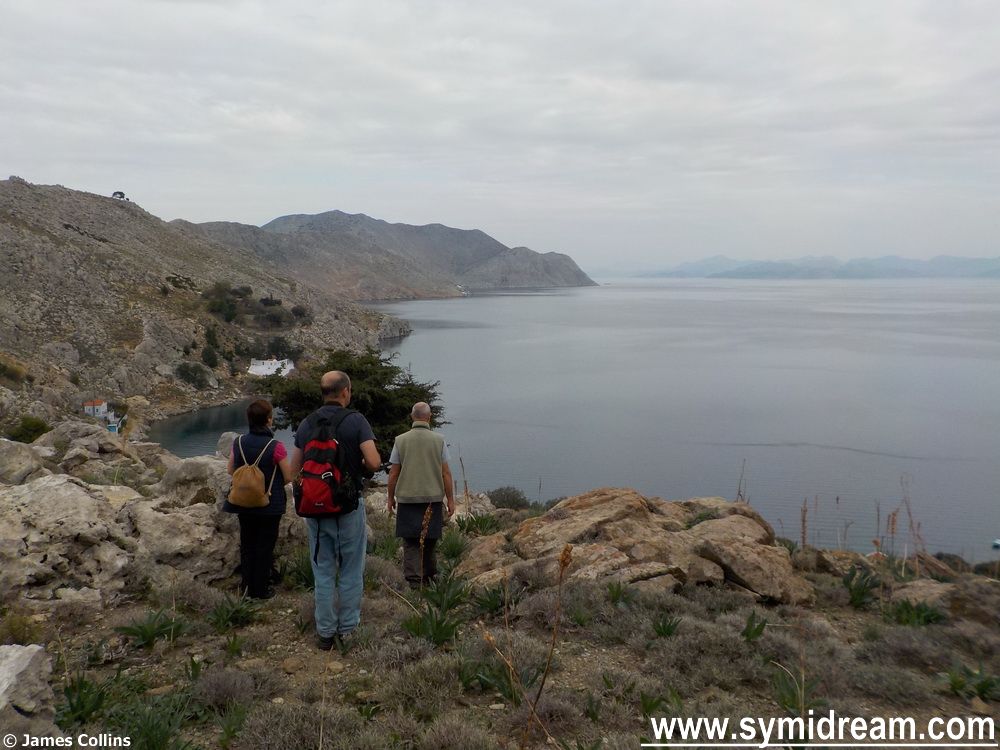
And that’s for tomorrow when we find catacombs, mosaics and a glass of wine.